July 10 Lusk, Wyoming to Hot Springs, South Dakota

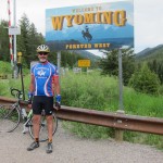
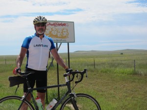
Welcome to South Dakota.  How would you like your heat, dry or humid?

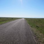
Spot the trees

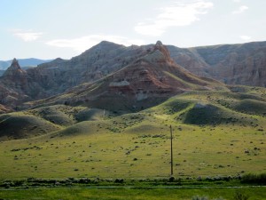
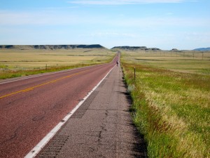
Today’s route was fairly easy to follow: ride north for 46 miles, turn right, ride east another 46 miles. (Still, one of our riders missed the turn).  Along the way, you leave Wyoming and enter South Dakota. On the last long hill before leaving Wyoming, I looked ahead and counted all the trees I could see.  On the right side of the road, I didn’t see any trees at all out to the horizon.  On the left side of the road, I saw one lone tree. I thought, “Hmm… the left side seems to be the shady side.”  The change in terrain is almost immediate as you enter South Dakota.  All of sudden, you start seeing pine trees and rocky outcroppings instead of long, rolling, grassy knolls.  Tomorrow, we’ll enter the Black Hills, one of the prettiest and best kept secrets in America. Unfortunately, the Black Hills contain a lot of hills so we’ll be doing a lot of climbing.

Whereas Lusk was all about ranching and agriculture, Hot Springs is more about tourism.  There really are hot springs in the area and they were enjoyed by the Sioux and Cheyenne long before we arrived.  Hot Springs is also the gateway to the Black Hills, Mt. Rushmore, the Crazy Horse monument, and various other attractions, like a wooly mammoth and a number of weird and wonderful caves.   Perhaps because of the economic differences, there are also demographic differences.  For every 100 females over the age of 18 in Hot Springs, there are 106.7 males.  In Lusk, on the other hand, there are only 74.7 males for every 100 females.  Perhaps that’s why Horace Mann said, “Go west, young man.”
Day’s distance: 93.9 miles (151.1 km)
Average speed: 17.5 mph (28.2 kph)
Day’s climb: 2,880 feet (877.2 meters)
Total distance: 1,595.1 miles (2,567.1 km)

Posted in The Ride, Uncategorized | 2 Comments

July 9 Casper to Lusk, Wyoming

Spot the Schooner

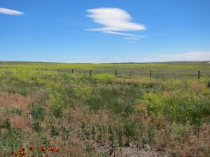
Back into the oceanic grasslands for the 107-mile run from Casper to Lusk. Casper seems like an up-and-coming place.  It even has a minor league baseball team — the Casper Ghosts. Lusk is a much smaller town on the edge of the vast grasslands ocean.   It’s a pretty place that seems to be the hub of the local agricultural communities.  As we came up a green, grassy hill today, I saw low clouds hanging just above the horizon. The whole scene seemed like low clouds scudding over a green, swelling ocean.  No wonder they called covered wagons Prairie Schooners.

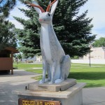
I spotted another animal for Roadkill Bingo — a jackalope.  Unfortunately, my camera battery was dead so I couldn’t document my find with a photo.  I did stop in Douglas, Wyoming, however, to take a picture of their town’s official jackalope.  Apparently, Douglas was the first place the jackalope was found and identified as a separate species.

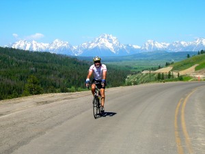
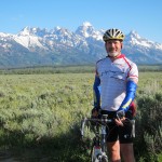
Most of the pictures I have of myself show me standing around with some pretty scenery in the background.  I don’t have many action pictures because my camera is in my pocket when I’m in action.  So, I’m very thankful that Jim Benson, our mechanic, took this photo of me climbing Togwotee Pass the other day.  When Jim took this picture, I still had about 15 miles of climbing to go to reach the summit. Some nice mountains in the background, no?

When we got into Lusk today, my buddy Columbus Dan and I walked over to the local Subway for lunch.  The place was full — there’s a parade to honor Lusk’s foundation day later today.  As we waited in line, we chatted with a young woman who’s a student at Valley City State University in Valley City, North Dakota.  She had just traveled with a youth group to the YMCA of the Rockies in Colorado and was headed home.  During the course of our conversation, I mentioned that I was raising money for MS.  After we got our sandwiches, the young woman came to our table, said “I think what you’re doing is wonderful.  Here’s five dollars. God bless you” and disappeared.  It’s one of the sweetest, most generous donations I’ve ever gotten.  I don’t know whom to thank so I’ll just thank Valley City State University.  Thanks, VCSU — you’ve got some pretty neat students.

Day’s distance: 107.1 miles (172.4 km)
Average speed: 19.1 mph (30.7 kph)
Day’s climb: 2,550 feet (777.2 meters)
Total distance: 1,501.2 miles (2,415.9 km)

Posted in The Ride, Uncategorized | 2 Comments

July 8 — Casper, Wyoming — Rest Day

Today is our second rest day — and a well needed one since we’ve pedaled 396 miles in the past four days.  I talked to a lot of our riders over breakfast and they say they’re feeling better today than on our first rest day in Boise.  I’m feeling the same way. Apparently, all this exercise is actually making us stronger.

Suellen drove up from Denver to join us – always a happy occurrence.  Anne Petrie, one of our old friends from England, came along with her.  Anne flew all the way from London to see the Wild West and visit our biking crew.   The highlight of the day was a visit to the National Historic Trails Interpretive Center.  It’s essentially a museum — with lots of interactive features — that highlights the history of the Oregon, California and Mormon Trails.  Loads of fun and definitely worth a visit if you’re in the Casper area.  (More info at: http://bit.ly/n8nGPz).

With the help of the local chapter of the National MS Society, I also did a radio interview this morning and a TV interview this afternoon.  I’ll send a link to the website as soon as I can.  Until then, it’s nap time.

Posted in The Ride, Uncategorized | Leave a comment

July 7 Riverton to Casper, Wyoming

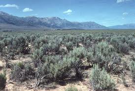
I’ve been thinking about sage brush today.  It’s hard not to think about sage brush in Wyoming.  Most of us would claim to be smarter than sage brush.  So, here’s a conundrum. How come sage brush can do photosynthesis and we can’t?  Photosynthesis combines water and sunlight to create energy. The only waste product is oxygen. Meanwhile, we’re debating the merits of nuclear energy, shale oil, hydro-fracking, and so on.  If we could master photosynthesis, we would have all the energy we could possibly need.  I mean, how hard can it be?  Sage brush can do it.

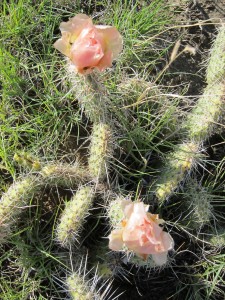
The earth and sky in Wyoming are so huge that I’ve run out of superlatives.  Some of the grasslands we cycled through looked more like oceans than land — trackless waves of grass blowing gently in the wind.  Getting lost in the grasslands would be similar to being stranded in a lifeboat in the ocean.  There are no features to navigate on; you could only plot your location from the stars.  Since the bigness of the land is overwhelming, I started to look for small things instead.  I soon found hundreds of cactus — no more than a foot tall — that were sending out their flowers. Lovely but virtually invisible in the Wyoming wilderness.

Wyoming is so wide open that there are very few places that can accommodate a crew as big as ours. Between Riverton and Casper, Hiland is one of the big towns.  The Hiland road sign claims a population of 10 but I think it’s an exaggeration. Since there’s no place to stop, we had to go all the way to Casper — a total of 120 miles. We started early — I was on the road by 5:45 — to take advantage of the cool, dry, still air. Generally we were lucky with the wind; it rarely blew directly into our faces.  Still we were all pretty well cooked by the time we got to Casper.

Today’s ride included several milestones:

  • Longest ride (1) — I’ve never pedaled so far in a single day
  • Longest ride (2) — it’s the longest ride of our tour.  The next longest ride is a mere 117 miles in South Dakota.
  • Back-to-back — it’s the first time I’ve ridden centuries (100 miles or more) two days in a row

Day’s distance: 120.2 miles (193.4 km)
Average speed: 16.3 mph (26.2 kph)
Day’s climb: 2,660 feet (810.7 meters)
Total distance: 1,394.1 miles (2,243.6 km)

Posted in The Ride, Uncategorized | 2 Comments

July 6 Dubois to Riverton, Wyoming (with a detour)

Wyoming seems like a schizophrenic state. It’s beautiful but austere.  It’s hot and dry but still filled with snow.  It’s down-home ranch hands and exotic corporate jets.  It’s Dubois, a real cowboy town and Jackson, where you’re not sure if the cowboys are locals or imports from New York City. Even the colors seem schizophrenic. Just look at the two photos here.  They were taken from the exact same spot.  All I did was turn around.  Looking north, you see the green side and the soft pastel colors of a painted desert.  The colors are subtle, pretty, and nicely blended. Looking south, you see the red side.  The colors are bright, uniform, and almost harsh.  There’s nothing subtle about them. On the green side, it looks like velvet.  On the red side, it looks like Mars.  And all you have to do is turn around.

Wind River

Today was supposed to be an easy run from Dubois to Riverton.  (Yes, Riverton is the setting for Brokeback Mountain).  Because the Wind River overflowed its banks and washed out part of the highway, however, we had to take a longish detour through the Wind River Indian Reservation. The reservation sits in a large, circular valley.  So we had a steep climb to get into the valley and an even steeper climb to get back out of it.  After climbing out of the valley, we stopped in Kinnear (population 44) for a rest and then did the last 20 miles directly into a stiff headwind.  Ultimately, we did my favorite kind of century — just barely over 100 miles.

Dubois is a cowboy town so several of our riders went square dancing last night.  As it happens, my father was a square dance caller and my sister and I grew up square dancing. I think my Dad’s square dancing club met on the third Friday of every month.  I had my entire cowboy outfit and my sister had acres of petticoats.  It was a lot of fun until I got to that age when everything my parents did was totally lame.  Last night, I was too tired to go but Lovely Lucy led a pack to the dance hall.  According to multiple reports, Lucy had the cutest cowboy in town as her dance partner.  Lucy’s evaluation, however, was that she was less interested in a cowboy and more interested in someone who looked like a “Spartan warrior”.   I think she’ll be reminded of that comment for quite some time.

Day’s distance: 100.9 miles (162.4 km)
Average speed: 16.7 mph (26.9 kph)
Day’s climb: 3,800 feet (1158.2 meters)
Total distance: 1,273.9 miles (2,050.1 km)


Posted in The Ride, Uncategorized | 1 Comment

July 5 Jackson to Dubois, Wyoming

Another big hill climbing day took us to the top of Togwotee Pass at 9,658 feet (2,944 meters).  Togwotee is the highest elevation we’ll reach on this trip and also the Continental Divide.  If water can make it from here to the Atlantic, I bet we can too. Rumor is that our trip is all down hill from here to the Mississippi River.

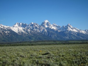
We started the day in Jackson, a very pretty cowboy town and a tourist center for hiking, skiing, fly fishing, hunting, kayaking, canoeing and just about any other outdoor sport you can imagine.  We rode in a gradual ascent from Jackson into Teton National Park and were treated to beautiful views of the entire Teton range for about three hours. (I don’t mean to brag but Elliot and I climbed Grand Teton when he was 13). It was hard to keep our eyes on the road when we had such a majestic panorama just off our left shoulders. After 30 miles or so, we turned right towards Dubois (instead of left towards Yellowstone).  Almost immediately we began to climb toward Togwotee Pass.  We kept climbing for almost 27 miles.  Togwotee is higher than Teton Pass but the gradient is much less steep — meaning that you have to pedal for a much longer way. The good news is that after such a long climb, you get an equally long descent into Dubois.

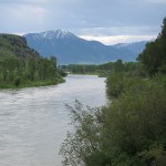
As we crossed the Continental Divide, we left the Snake River behind and picked up the Wind River.  Like every other river we’ve seen, it’s running perilously high.  In fact, it’s washed out the road ahead of us.  Tomorrow, we were planning to take Route 26 on a fairly easy 79 mile run to Riverton.  Unfortunately, portions of Route 26 are under water. Fortunately, the sections that are washed out are after the turnoff to Route 287.  So we’ll detour onto 287, go to the town of Wind River, then double back to Kinnear where we pick up Route 26 again and follow it on to Riverton.  The detour adds 16 miles, giving us a 95 mile day.  Fortunately, a lot of it is downhill.  (It’s a good thing the washed out area is after the turn to 287; otherwise, we would have to detour several hunderd miles.  There aren’t many roads out here).

We passed a number of milestones yesterday and today:

  • We’ve pedaled more than 1,000 miles.  Only 2,600 to go.
  • We entered our third state. Only seven more to go (plus Ontario)
  • We reached the highest point in our trip – 9,658 feet.
  • We crossed the Continental Divide.

More male maladies: Yesterday, Leader Jeff (as opposed to Rider Jeff) was trying to work his way around a detour in Victor, Idaho when he flipped off his bike and broke his wrist. So far, the women are still doing fine.

Day’s distance: 87.7 miles (141.1 km)
Average speed: 14.7 mph (23.6 kph)
Day’s climb: 3,800 feet (1158.2 meters)
Total distance: 1,173 miles (1,887.7 km)

Posted in The Ride, Uncategorized | 4 Comments

July 4 Idaho Falls, Idaho to Jackson, Wyoming

Welcome to Wyoming.  How would you like your wind?

What a ride we had today.  A brilliant sunrise over Idaho Falls was a good omen. We loaded and left by 6:30 and cruised through nearly empty streets.  Part of our route was lined with chairs that people put out last night in anticipation of today’s Fourth of July parades.  Then a long, nearly flat stretch for 15 miles or so.  As we began climbing the first big hill, the wind picked up, buffeting us from side to side.  Then we dropped into a gorgeous valley that seemed completely isolated from the rest of the world.  I’m pretty sure I spotted Julie Andrews singing, “The hills are alive …”

The Snake is swollen

The valley protected us from the wind until we turned north and started climbing Pine Creek Pass.  The road climbs at a 6% grade to the top of the pass at 6,764 feet. It seemed hard at the time but later we realized that it was just a little appetizer to get us ready for Teton Pass. From the summit of Pine Creek Pass, we had a nice run down to the town of Victor, Idaho, passing the Snake River several times.  Each time, the river seemed fuller and more swollen than the last time we saw it. It must be very near flood stage.

From Victor, we turned east again and started climbing.  A few miles out of town, we crossed into Wyoming and the winds picked up.  Then the pass got steeper and steeper.  I had trained on Trail Ridge Road in Colorado, a 23-mile uphill grade that rises to nearly 12,000 feet. So I thought I was ready for Teton Pass.  The big difference is that Teton Pass is much steeper than Trail Ridge.  Teton averages a 10% grade.  Trail Ridge doesn’t get much steeper than 7%.  That’s a big difference and the headwinds on Teton Pass didn’t help much.  I had to stop once to gobble some nutrition but eventually I got to the top — 8,431 feet —  to be rewarded by beautiful view of Jackson, Wyoming.

From the top we had a steep — also 10% grade — run down to Jackson.  You can pick up a lot of speed very quickly on a 10% grade.  It’s fun but also a bit nerve-wracking especially when you can go faster than some of the blimp mobiles on the road today.  At one point, I thought seriously about passing a Winnebago but ultimately decided that discretion is the better part of valor.

Before leaving Idaho, I’d like to record some of my favorite signs from the potato state:

Best technology company name:  Spudnik Technologies
Best Sinclair sign:  Live rude girls
Best middle school sign: Confused about the rapture?  Don’t worry — it’s not the end of the world.

Day’s distance: 88.5 miles (142.4 km)
Average speed: 13.1 mph (21.1 kph)
Day’s climb: 5,500 feet (1676.4 meters)
Total distance: 1,085.3 miles (1,746.6 km)

Posted in The Ride, Uncategorized | 1 Comment

July 3 Pocatello to Idaho Falls, Idaho

As falls Idaho, so falls Idaho Falls

Whew… this is a big country.  We’ve pedaled almost 1,000 miles already and we haven’t even crossed two states yet.  Today was an easy 65-miler from Pocatello to Twin Falls.  We were up early and on the road by 7:30 to take advantage of the cool, still air.  We zipped through the first half, did one SAG stop, and then zipped through the second half.  We cruised mainly through agricultural terrain with some very pretty small towns scattered along the way.  On Sunday morning, the only traffic was people going to church.  The only excitement was provided by several dogs that decided to chase after us.  Even they were lazy – they’d chase the first rider and then lie in the shade and bark half-heartedly.

With the help of the National MS Society, I’m getting more press coverage for our fund-raising efforts.  Yesterday, the Idaho State Journal — the daily paper of Pocatello — had a very nice article about me and the trip.  You can read it at: http://bit.ly/mxizT5

This would be a great trip to play Roadkill Bingo on.  You pick seven animals and the first player to spot five dead on the road is the winner.  So far, I’ve seen deer, fox, coyote, raccoon, snakes (several), skunks (saw a few, smelled more), bobcat, and what may have been a possum.  Suellen actually has a business idea centered around roadkill.  She thinks there’s enough roadkill in Colorado that she can collect specimens, have them stuffed, and then sell them to middle schools and high schools for their science projects.  I’ll put her in touch with Science Mary.

I want to give a special shout out to my buddies, Johnny G. and Jill, 11-year-old twins (almost 12) from Castle Rock, Colorado.  Johnny G. and Jill have a big map and are following our progress across the country. They also sent me a tin of very special, very tasty home-made brownies.  They were so good that I didn’t share them with anybody (except Suellen, of course).  Special note to Johnny G. — Brush up on your chess skills. Learn the Ruy Lopez opening.  I’m ready to play.

Late breaking news – there was a little more excitement than I knew about today.  One of our Dans (we have four Dans on the trip) took a tumble after bumping wheels with another rider in a pack.  Fortunately, it was mainly road rash and Dan was able to ride the rest of the way.

Day’s distance: 66.1 miles (106.4 km)
Average speed: 16.3 mph (26.2 kph)
Day’s climb: 760 feet (231.6 meters)
Total distance: 996.8 miles (1,604.2 km)

Posted in The Ride, Uncategorized | 3 Comments

July 2 Burley to Pocatello, Idaho

Spot the Horizon

We’re in big sky country now.  As we trekked through the first 30 miles this morning, we followed a nearly abandoned highway through the broadest, most open terrain imaginable. We could see the horizon in every direction. The sky (not cloudy all day) stretched over us like an immense dome. This is the territory where the pioneers said they could see to the middle of next week. They literally could see where they would be ten days hence.

In the early morning, the air was still and we cruised along nearly flat terrain, surrounded by billions of acres of sage brush.  By mid-morning, we ran into headwinds of 15 to 20 miles per hour and got a taste of what it’s like when the wind comes from the east. Everything slowed down. Several people were certain they had gotten flat tires and stopped to check their air pressure.  By early afternoon, we were riding in pace lines to help each other pull through the wind.  We’ll become experts in pace lines once we hit the winds of Wyoming.

We touched on the Oregon trail at multiple points today, including Register Rock where pioneers stopped to sign their names.  (They didn’t call it graffiti back then).  We also passed within a few miles of fabled Eight Hour Canyon.  The canyon is so deep and broad that it takes an echo eight hours to return.  When the pioneers passed through, they shouted: “Time to get up!” just before bedding down at night.  Eight hours later, they got their wake-up call, just like clockwork.

Now it’s time to introduce Science Mary, another one of our riders.  Mary reminds me of my sister, Shelley, except that Mary is smarter, stronger, cuter, sweeter, and has better hair.  Other than that, they’re just alike.  Mary’s a good, strong rider and she’s also a runner. She’ll do a 100 mile bike ride with us and then do a seven mile run to cool off. She can finish a seven mile jaunt in about the time that I can finish a nap.  What connects Mary and Shelley, however, is that they both are enthusiastic teachers of middle school science.  Middle school students are tweeners — they’re not kids anymore but neither are they young adults.  They’re rapidly transitioning form little cherubs to hormone-ravaged teenagers.  I’ve got three words for anyone who can teach science to these kids: God bless ’em. Oh, and: Double their salaries.

Day’s distance: 86.4 miles (139.0 km)
Average speed: 14.9 mph (23.9 kph)
Day’s climb: 1,200 feet (365.7 meters)
Total distance: 930.7 miles (1,497.8 km)

Posted in The Ride, Uncategorized | Leave a comment

July 1 Twin Falls to Burley, Idaho

Jump this!

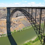
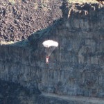
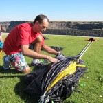
The shortest day of the trip — 39 miles — turned into a sight seeing adventure as we ambled along the Snake River.  We started by watching the BASE jumpers parachuting off the Snake River bridge, just outside of town.  The bridge is 486 feet (148 meters) above the river.  Idaho laws make it illegal to attach anything to a bridge which pretty much eliminates bungee jumping.  But there’s no law saying you can’t jump off a bridge. (Hey, this is America!)  So, jump they do … with glider parachutes.  They jump, execute a quick turn, and land just over the trees on the river’s edge. We saw six people jump. Some do tricks — double back flips — others pull the cord as they leap. We chatted with

An eligible bachelor

a half dozen young men who were re-packing their chutes for another jump.  (Apparently, they jump all day long when they have good weather).  I asked, “How many of you guys are married?”  That provoked gales of laughter. Finally one young man sheepishly confessed that he was engaged and that his jumping days might be nearing an end.   The young men’s culture seemed to have a lot in common with kayakers (Utah), rock climbers (Colorado), back country skiers (anywhere in the West), surfers (California, Hawaii), and canyon hikers (Arizona).  They all seem like young Peter Pans who are too busy being busy to worry about growing up.

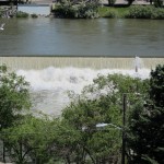
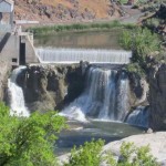
We then took off toward Burley.  Along the way, we gazed numerous times at the fabulous canyon carved by the Snake River.  We also stopped at Shoshone Falls which were very pretty but seemed more like a general industrial zone because of all the hydroelectric equipment in the area.  If you could mentally edit out the power lines and industrial sheds, it made for a very pretty picture. Unfortunately, a camera can’t edit it all out so you see the picture at the right.

The road to Burley followed the Interstate and wasn’t terribly interesting.  More agricultural fields; more irrigation equipment; more large trucks.  More important: lots of friendly people who waved and/or gave us the thumbs up sign as we mosied along. Probably the most interesting thing we saw was a crop duster working the fields near our hotel in Burley. Tomorrow is a longer day — 88 miles to Pocatello — so it’s nice to have slower- paced sightseeing day today.

Day’s distance: 45.2 miles (72.7 km) — 39 to Burley; 45.2 miles with sightseeing detours
Average speed: 15.1 mph (24.3 kph)
Day’s climb: 1,150 feet (350.5 meters)
Total distance: 844.3 miles (1,358.8 km)

Posted in The Ride, Uncategorized | 1 Comment