June 30 Mountain Home to Twin Falls, Idaho

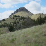
Ain't she a butte?

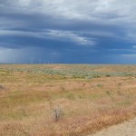
The terrain became much more rugged as we did a fast ride — nearly a century — with a gradual climb from Mountain Home (elevation 3,146 feet) to Twin Falls (3,745 feet). We had a nice tailwind as we entered a land filled with buttes, canyons, and gorges.  We saw potato farms and wind farms, two of Idaho’s big crops.  Idaho’s biggest crop might well be sage brush if only we could find some practical use for it. While we saw produce for most of the morning, by the afternoon we had entered cattle country and saw (and smelled) one feedlot after another.  It’s very dry out here and each agricultural field was serviced by a huge infrastructure of irrigation equipment.  When the wind was just right, the sprinklers would send a cooling spray of water over us.

We followed the Malad River and Snake River most of the day.  One of the first major water control projects on the Snake River was Milner Dam, completed in 1905.  The dam and a series of irrigation ditches and canals made large-scale agriculture feasible for the first time. The dam also created the raison d’etre for the town of Twin Falls which was founded when the Milner Dam construction began.  One of the earliest planned communities in the United States, the town was laid out by a French architect named Emmanuel Louis Masqueray. The streets were laid out in a grid but not north-south and east-west. Rather, they extended northeast-southwest and northwest-southeast.  Masqueray apparently chose this arrangement so that sunlight would enter every house, every day.
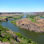
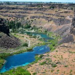
If you’re my age (more or less), you may be thinking, “I know I’ve heard of Twin Falls but I can’t remember why.”  Think back to September 1974.  Still can’t get it?  Think of Evel Knievel.  Yes, it was near here that Evel made his fabled but ill-fated rocket cycle jump over — actually into — the Snake River.  Apparently the parachute deployed too soon and Evel wound up in the water rather than on the opposite rim.  Evel’s launch pad is barely visible in the photo at left — it’s the small spot of lighter brown near the top center of the picture.

I tried my own death-defying leap today.  My right knee bothered me a bit near the end of my ride.  So I did what the racing pros do (and what the doctor on our trip recommends), and sat in a tub of ice water for ten minutes.  It certainly made my knee feel better but it may be because it made everything below my waist feel numb.  I hope I don’t have to do this every day.

Day’s distance: 97.7 miles (157.2 km)
Average speed: 17.4 mph (28.0 kph)
Day’s climb: 2,350 feet (716.3 meters)
Total distance: 799.1 miles (1,286.0 km)

Posted in The Ride, Uncategorized | 3 Comments

June 29 Boise to Mountain Home, Idaho

A tender farewell…romantic music swelling in the background.  As Suellen pulled me close, tears staining her freckled cheeks, she looked up with dewy eyes and said, in a tremulous voice, “We’ll always have Boise.”

Well, OK… that’s not really the way we said our farewells, but it was awfully nice to have Suellen in Boise on our rest day. Boise seems like a very nice town — it’s fresh and fun and bright.

SE on the (overflowing) Boise River

Boise is to Idaho as Austin is to Texas — a liberal island in a conservative sea.  I half-expected to see signs saying, “Keep Boise Weird”.  We walked along the Boise River and saw an eagle fishing right in the middle of the city.  We also went to the municipal rose garden and cruised around downtown.  In the afternoon I washed all my bike clothes and cleaned up my bike while Suellen read in the shade.  Then a nice swim in the hotel pool.  For dinner we had a lot of nice restaurants to choose from.  Many restaurants (and breweries)  are dedicated to local fare. We ate in a sidewalk cafe that organized its beer menu by how far away the brewery was. I especially liked a beer that was brewed less than a mile from the restaurant.  But that was yesterday… today I’m in Mountain Home and Suellen is flying back to Denver after a tender farewell.

Today was a fast, flat ride to Mountain Home.  We picked up a nice tailwind and covered the 53 miles in slightly less than three hours.  We were also motivated by the fact

Spot the rainbow

that a big thunderstorm was forming behind us.  Our first clue was a morning rainbow — just visible over my left shoulder in the picture.  Rainbows are almost always in the afternoon and to the east.  As the sun sinks in the west, it illuminates water vapor in the eastern sky.  (It’s a good way to orient yourself if you’re lost).

Prairie Storm Brewing

Morning rainbows — to the west — are rare because there’s not much water vapor in the air.  A morning rainbow is often a precursor to an especially large thunderstorm.  There’s more water vapor in the air and the storm has all day to heat up before breaking loose in the afternoon.

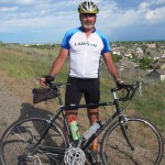
I wore my Lawson jersey today for sentimental reasons. I worked for Lawson for 4½ years, including three years in Sweden.  Lawson is being acquired by Infor and the deal closes today — so Lawson ceases to exist as an independent company. It’s good for stockholders (including me) but bittersweet for former employees.  I just hope my former colleagues land on their feet.

Day’s distance: 53.7 miles (86.4 km)
Average speed: 18.1 mph (29.1 kph)
Day’s climb: 1,400 feet (426.7 meters)
Total distance: 701.4 miles (1,128.8 km)

Posted in The Ride, Uncategorized | 2 Comments

June 28 Rest Day (and Media Day) – Boise, Idaho

As I ride across America, I’m working with local chapters of the National MS Society to help build awareness of MS and raise funds for research. Yesterday — with a lot of help from two of the Society’s marketing gurus, Juliann Fritz and Courtney Frost — I briefly became a media star in Boise.  The local Fox News channel did a 3 minute piece on the ride for their evening news slot.  You can watch the video at http://www.ktrv.com/story/14986701/ms.

The Idaho MS chapter is also doing their big MS-150 bike ride fundraiser — called Road, Sweat & Gears —  on July 23 and 24 in McCall, Idaho.  If you want to know more, please visit bikeMSidaho.org.  McCall is a beautiful place so this is a good opportunity to have some fun, see some unforgettable scenery, and support a good cause.

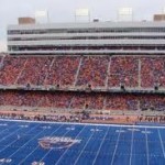
Other than basking in my brief media glory and catching up with Suellen, I’ve mainly been relaxing today.  We took a long walk along the Boise River (also filled to overflowing), visited the municipal rose garden, and saw the football stadium with the famous blue field.  Other than that, it’s rest, relaxation, and laundry.  Back in the pedals tomorrow.

Posted in The Ride, Uncategorized | 2 Comments

June 27 Ontario, Oregon to Boise, Idaho

Goodbye Oregon.  Hello Idaho.  How would you like your potatoes? A nice 64-mile run today (a “short day” we now call it) with beautiful weather through lush agricultural fields, featuring everything from potatoes to onions to asparagus to lettuce to the largest field of mint I’ve ever smelled. Slightly uphill throughout the day — Ontario is 2,150 feet and Boise is 2,730.  We were all motivated to arrive and savor a day off tomorrow. I was especially motivated as I knew Suellen would be waiting for me — so motivated, in fact, that I was the first to finish the route.

We’re in potato country now.  Since its humble origins in Peru, the potato has been so successful that you have to ask: are we cultivating the potato or is it cultivating us?  This lowly tuber has convinced us to propagate it to virtually every agricultural region in the world. Despite the fact that it wasn’t known outside the Americas until the Spanish conquest, the potato is now the world’s fourth largest food crop — following rice, wheat, and corn.  The Spaniards introduced the potato to Europe around 1580. (What did they eat before then?)  The Basques adopted it from the Spaniards when they realized that it was the perfect food for their long-distance cod fishing voyages.  The Basques usually stopped in Ireland to dry their catch and introduced the potato to the Irish. Unfortunately, the Spaniards only introduced a few of the 5,000 varieties of potatoes to Europe.  So when the potato blight hit Ireland (and later, Sweden) there were no varieties with natural immunities.  The entire crop was destroyed and people either starved or migrated.  Ireland and Sweden lost people; Boston and Minnesota gained them.  It’s a good lesson in the need for genetic diversity.

Basque Festival - Boise

So what happened to the Basques?  A bunch of them landed right here in the Boise area, drawn by the agricultural and herding opportunities in the area.  Boise has a thriving Basque-American population anchored by the Basque Museum and Cultural Center (http://www.basquemuseum.com/).  Boise State University recently started a Basque Studies program (to complement its football team) and Boise has America’s only Basque language pre-school, the Boiseko Ikatsola (http://www.boisekoikastola.org/). This may be the best place in America to learn the Basque language, dances, cooking, and culture.  That seems like a nice reason to come back to a beautiful town.

Day’s distance: 64.7 miles (104.1km)
Average speed: 15.0 mph (24.1 kph)
Day’s climb: 1,650 feet (503 meters)
Total distance: 647.7 miles (1,042.4 km)

Posted in The Ride, Uncategorized | Leave a comment

June 26 Baker City to Ontario, Oregon

Oh, what a difference a downhill day makes!  We left Baker City — elevation 3,450 feet — early this morning and arrived in Ontario — elevation 2,150 feet — by mid-afternoon.  We also climbed 2,100 feet.  Work the math and we must have descended 3,400 feet, making for a very nice day.  This is truly the country where the skies are not cloudy all day. Today, they were not windy either, making everything easier.

A variety of minor maladies are affecting us.  Three guys sat out the day because of blistered bums.  Another had to drop out because of a sharp pain in his knee.  The Locomotive had to fly home to recover from the viral infection in his chest; he’ll rejoin us in Idaho Falls.  Come to think of it — it’s only the guys who are dropping like flies.  The women are doing fine.  Is this yet more evidence that women are stronger than we are?

The Snake is snaky

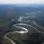
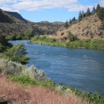
We’re getting a real education in the riverine West.  So far, we’ve followed the Columbia and Deschutes Rivers, Crooked Creek, the Powder River and the Burnt River (did the Powder River explode and burn the Burnt River?), the Malheur, the Payette, and today, the Snake River.  (You can see in the image at the left why they call it the Snake). Without exception, the rivers were filled to the verge of overflowing.  And there’s still plenty of snow left in the mountains.  It’s going to be an interesting flood season.

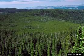
We’re now leaving the pine forests and entering potato country.  Orgeon’s pine forests look pristine and healthy.  In other words,  just like Colorado’s pine forests looked before the bark beetle got the upper hand in Mother Nature’s arms race. Bark beetles burrow in to a mature lodge pole pine, suck the life out of it, and then swarm to another tree to repeat the process.  Roughly 3.5 million acres are affected — that’s the size of Delaware. Forestry experts say 100,000 pine tress are falling in Colorado every day.  To control beetle colonies, you need temperature of minus 40 or so for a week or two. Colorado got such cold spells regularly in the past but no more. So the beetle colonies never die — they just come back every spring, more numerous and hungrier. And they’re moving west.  They’ve already crossed the continental divide.  They haven’t reached Oregon yet but I expect they will in the next five to seven years.  Memo to Oregon: enjoy the pine forests while you can.

Day’s distance: 84.7 miles (136.3km)
Average speed: 17.9 mph (28.8kph)
Day’s climb: 2,150 feet (655 meters)
Total distance: 583 miles (938.2km)

Posted in The Ride, Uncategorized | 5 Comments

June 25 John Day to Baker City, Oregon

Ever seen a three-humped camel?  That pretty much describes our day: up/down — up/down — up/down.  We rode three passes in succession, topping out on Dixie Pass at 5,277 feet.  In total, we climbed 4,650 feet.  But Baker City is only about 300 feet higher than John Day, so we had some 4,350 feet of descent.  One descent brought us to a pretty little roadside inn where we all gorged on blackberry cobbler.

The people of eastern Oregon have the good sense to build their towns ten to 15 miles from the nearest pass.  So we start each morning with a nice, steady ride to warm up and then start climbing.  After the last pass, we typically get a nice flat run to the next town. Today was no exception.  We started — in 40° weather — with a gentle 15-mile rise.  Then the hills, then a 21-mile stretch of flat, straight road into Baker City.  The last stretch was in a broad valley, with the winds blowing straight into our faces.  The Bernoulli effect got pretty intense at times.  I tried to slip under the wind by riding in my drops most of the way but I don’t think it really helped much.

I rode up the second pass with Lovely Lucy.  At 22, Lucy is at the opposite end of the spectrum from Tucson Terry — she’s the youngest rider in our group.  Three words for Lucy: walking energy field.  If you slip within Lucy’s orbit, you immediately perk up as if you had just drunk two cups of coffee.  She’s a mere slip of a girl but she’s very strong, has a brilliant smile and a perfect inability to stay quiet for more than a few nanoseconds. (By the way, it’s a myth that guys don’t like talkative women. We’re not thinking, “I wish she’d be quiet”.  Rather, we’re struck dumb and wondering, “How does she do that?”)   Lucy’s from the “bottom of England” and speaks quickly with an accent that’s unfamiliar to us. I’m not sure that any of us completely understand what she’s saying, but it rarely seems to matter.  Today, Lucy chatted me up for five miles as we rode the second pass. It’s a great way to ride a pass — I hardly noticed that we were climbing a 6% grade. Truth be told: Lucy reminds me a lot of Suellen.  Same general form factor and same megawatt smile.  Lucy’s younger in  years but not in spirit.

Day’s distance: 81.3 miles (130.8 km)
Average speed: 13.9 mph (22.4 kph)
Day’s climb: 4,650 feet (1,417 meters)
Total distance: 498.3 miles (801.9 km)

Posted in The Ride, Uncategorized | 5 Comments

June 24 Prineville to John Day, Oregon

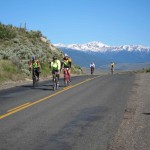
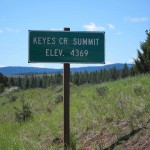
Up early and out the door — a big day covering 116 miles with two mountain passes.  We started cycling at 6:00 AM when the temperature was in the upper 30’s.  We passed through farmland for the first 15 miles and then started climbing to Ochoco Pass (4,720 feet).  It’s roughly a 15-mile climb so it takes a while but the gradients are not too steep. Then you get the benefit of all that climbing, a ten-mile bombing run down the back side. Then some flats and a much steeper, seven-mile climb to Keyes Creek Pass (4,369 feet).

The rest of the day consisted of rolling hills through lovely canyons and gorges.  Beautiful rivers and steep sided canyons that looked like something straight out of a western movie.  On the way up to Ochoco and Keyes Creek, we were in pine forests — not as thick as western Oregon and no birch trees — just pretty pines that were cool and aromatic.  After descending Keyes Creek, we re-entered the high desert ecosystem.  Trees were fewer and farther between with more grasses and wildflowers.  Some of the dappled hills reminded me of Sicily, except the dappling was by pine trees rather than olive trees.

Now we’re in John Day, named after an early trapper in the area.  For much of the latter half of the 19th century, the town was largely populated by Chinese immigrants, who were drawn to the gold rush.  Chinese citizens developed a trading post in the 1860s which later became a clinic and a general store.  Today, it’s the Kam Wah Chung & Company Museum.  It’s apparently one of the best examples of a traditional 19th century Chinese apothecary in the country.

We could use an apothecary today.  Blisters are starting to take their toll.  One rider had to drop out today because of blisters on his bum.  Cyclng is probably the only sport in which cover-your-ass is considered a positive strategy.  Also Steve, The Locomotive, has a viral infection in his chest and sounds like a dying frog.  Still, he did the entire route today. Wisely, I think he’ll take a rest day tomorrow.    Perhaps it’s time for a visit to Kam Wah Chung.

Day’s distance: 116.1 miles (186.8 km)
Average speed: 14.7 mph (23.6 kph)
Day’s climb: 5,000 feet (1,524 meters)
Total distance: 417 miles (671.1 km)


Posted in The Ride, Uncategorized | Leave a comment

June 23 Kah-Nee-Tah to Prineville, Oregon

Here’s a three-word synopsis of the trip so far: green-red-green.

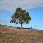
We started in the deep green forests of western Oregon — so dark they’re almost black.  Then we climbed into the high desert with its deep reds, yellows, and ochres — where one tree standing alone is noteworthy.  We’re now moving back into a greener region with more trees.  Not forests exactly but good stands of pine and deciduous trees.  The soil seems richer and more farmable.  There’s more irrigation and the horses and cattle — instead of being free range — are more likely to be found in fenced-in pastures.

We followed the Deschutes River, a major tributary of the Columbia and a key link in the Oregon trail.  The name is from the French — River of the Falls — an indication of the French presence in the early days of trapping.  It’s a rich blue-green band in an otherwise arid area.  We didn’t see any fish jumping but we did see at least one bald eagle and several eagle’s nests.

Now we’re in Prineville, a pleasant town of 10,00 people that has a rodeo every Saturday night.  Other than the rodeo, Prineville seems a little sleepy — it didn’t get its first Starbucks until 2006. The big new news  is that Facebook selected the town as a site for a major data center in 2010.  So your Facebook posts may be coming right through here.

Today’s ride was a simple 60-miler, with stiff headwinds at the start and one long hill that lasted about ten miles.  Most of us lollygagged around to save our energy for tomorrow’s monster ride: 117 miles and over 5,000 feet of climbing.

I introduced Steve “The Locomotive” Berthe yesterday.  Today, I’d like to introduce Tucson Terry.  At 74, Terry is the oldest person on this ride.  Originally from London, then from New Jersey, Terry finally saw the light a few years ago and moved to the southwest.  If I had only three words to describe Terry, I’d say: dog-toy tough.  Terry is perhaps the skinniest human being ever built.  He looks like a pile of tooth picks loosely joined with bubblegum. But he’s a hard rider.  I’m a pretty good hill climber — not in Loco’s league — but not bad.  So what does Terry do on the first big hill we hit?  He drops me.  I’m thinking: he’s older than I am, he’s skinnier than I am, he’s got a funny accent and yet he dropped me like a bad habit.  Hmmm … maybe it’s the bike.  I’m sure you’re going to hear more about TT in the weeks to come.

By the way, I forgot to mention where you can find The Locomotive’s blog. It’s at: http://berthe.squarespace.com/.  Check it out.  It’s got a lot more numbers than mine does.

Day’s distance: 59.8 miles (96.2 km)
Average speed: 14.4 mph (23.2 kph)
Day’s total climb: 3,300 feet (1,006 meters)
Total distance: 300.9 miles (484.2 km)

Posted in Uncategorized | 1 Comment

June 22 Welches to Kah-Nee-Tah, Oregon

I have racing stripes on my head!  Yesterday, it was cool and gray in the morning and I didn’t put on my ‘do rag under my helmet when we left.  Then we popped into the sunshine and I didn’t think anything of it.  The sun, of course, came right through the air vents in my helmet and left an nice racing stripe tan on my (ample) forehead.  From now on, I’m doing the ‘do rag thing.

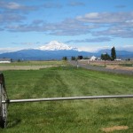
Today was just another day of breathtaking scenery.  We started in the heavy forest and quickly climbed two passes — each just slightly less than 4,000 feet.  Cool and clear and fresh and rhododendrons everywhere.  In addition to the two passes, there were several smaller hills along the way to the 45th parallel — halfway between the equator and the north pole.  In total, we climbed nearly a mile — one of the biggest climbing days of the entire tour. As we traveled southeast, we left the cool, damp forests behind and entered the high desert.  The air dried out quickly and the temperature rose.  The forest thinned out and opened into lush meadows filled with yellow and lavender wild flowers.  Then it got even drier and the trees virtually disappeared, replaced by low grasses and scrub. The earth turned deep red as well.  Many of the road cuts looked like multiple layers of red velvet cake. As we neared Kah-Nee-Tah, we could see the forest — anchored by Mt. Hood — behind us (above) and the desert — anchored by Mt. Jefferson — ahead of us (below). Notice the difference in the vegetation.

Now, it’s time to properly introduce my biking buddy, Steve Berthe.  Suellen and I met Steve and his wife, Ann, on a bike trip from Prague to Vienna.  He’s a strong biker to say the least.  In our first days of riding across America, Steve has been the first to finish the route each day. Steve is a few inches shorter than I am and weighs 20 pounds more — and it’s all muscle.  He punches a great hole in the air so we all like to slide in behind him. Thus, he’s acquired a new nickname: The Locomotive.  Truth be told: we often just call him Loco.  You’ll be hearing more about him in this blog.

While Steve likes to finish first each day, I have more modest objectives.  I just want to be the first rider named Travis to finish each day.  So far, I’ve been remarkably successful.

Day’s distance: 65.6 miles (105.6 km)
Average speed: 13.8 mph (22.2 kph)
Day’s climb: 5,150 feet (1,570 m)
Total distance: 241.1 miles (388 km)

Posted in Uncategorized | 1 Comment

June 21 St. Helens to Welches, Oregon

A quick 75 mile ride through rolling lush, rolling green hills thick with wildflowers.  A mild breeze all the way.  It seemed like the wild lupine and Queen Anne’s lace were cheering us on from the side of the road.

We have four Dans on this trip. I’ve been riding with Columbus Dan, so named because he’s from Columbus, Ohio.  We ride at about the same pace and it’s nice to have someone to zip along with.  It happens that Dan’s six-year-old triplet grand daughters live close to the route.  So we stopped in to visit.  Even puppies aren’t as cute as six-year-old girls. This was cuteness cubed. They stole my heart within minutes.

The first 20 miles or so were overcast — even foggy — and cool.  Then we popped out of the bad weather and saw Mt. Hood.  We followed the mountain for the next 50 miles, playing peekaboo as it ducked behind thickly forested hills and the occasional cloud. After stopping for burgers and shakes at Calamity Jane’s, we reached Welches in mid-afternoon. Welches can lay claim to the first golf course ever built in Oregon (back in 1928). Other than that, it’s pretty quiet around here.  The main attraction is that it’s in the gorgeous Mt. Hood recreation corridor.

A bit of bad luck yesterday as well.  The nicest guy in our whole group flipped off his bike and broke his collar bone.  He trained very hard for this trip so I’m betting he’ll be back next year.  So, that’s one less rider this year but one more next year.

Daily distance: 75.5 miles (121.5 km)
Average speed: 14.7 mph (23.6 kph)
Day’s climb: 3,150 feet (960.1 meters)
Total distance: 175.5 miles (282.4 km)


Posted in The Ride, Uncategorized | 3 Comments